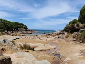
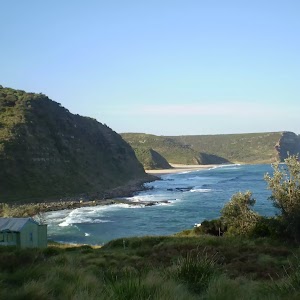
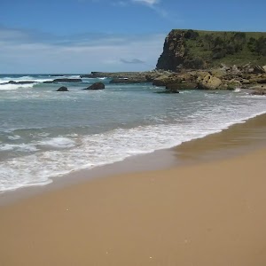
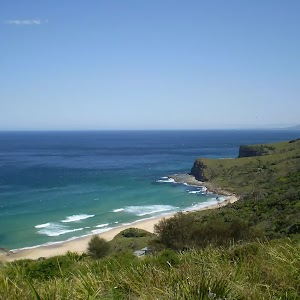
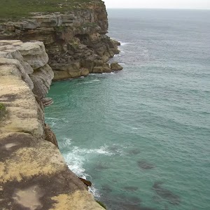
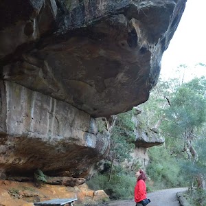
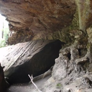
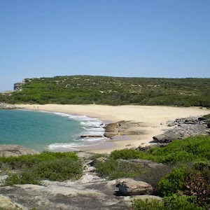
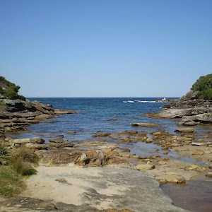
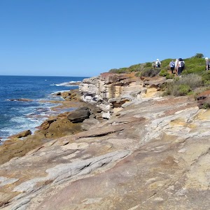
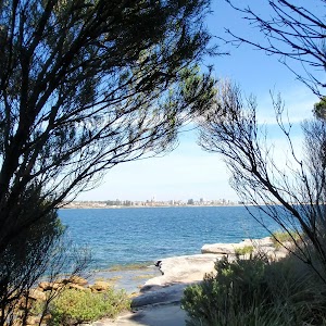
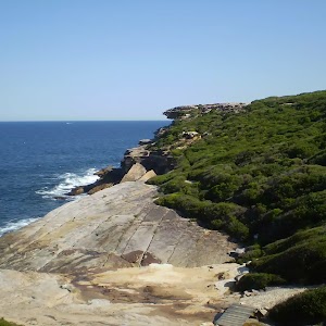
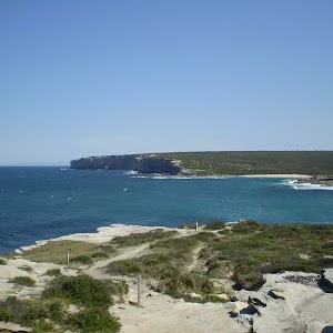
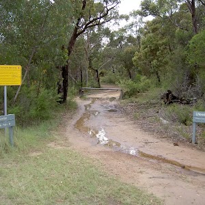
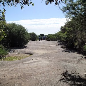
This return walk starts from the southern car park at the Wattamolla picnic area and winds south, further into the Royal National Park. The walk follows the service trail that provides views across the coast and then follows a bush track down into Curracurrang Cove. The cove is a nice narrow nook in the coast line where a number of archaeological findings have been made in the past.
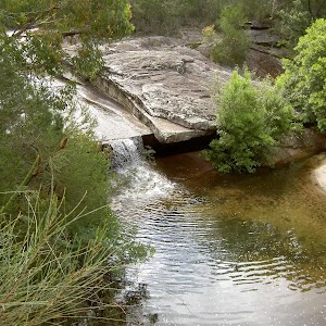
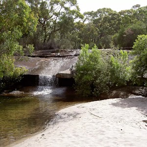
Wattamola picnic area to Curracurrang Cove

1 hr 15 mins

91 m
Moderate track
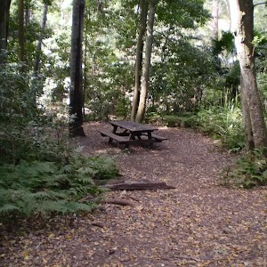
(0km) Wattamolla Picnic Ground Toilet Block → Overflow Carpark

150 m
4 mins
13m
-1m
Easy track
(0.15km) Overflow Carpark → Curracurrang Cove

1.4 km
26 mins
28m
-49m
Moderate track
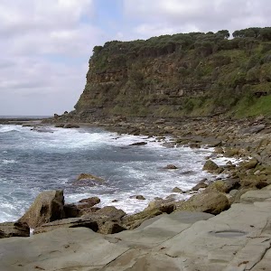
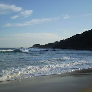
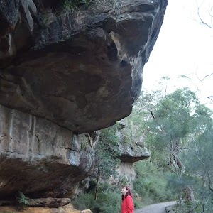
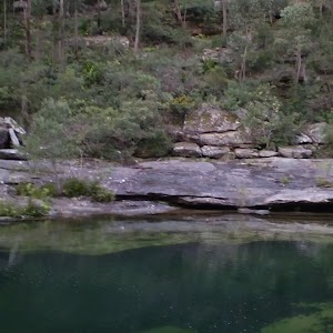
Curracurrang Cove
Maps for the Wattamola picnic area to Curracurrang Cove walk
You can download the PDF for this walk to print a map.
These maps below cover the walk and the wider area around the walk, they are worth carrying for safety reasons.
| Otford | 1:25 000 Map Series | 91294S OTFORD | NSW-91294S |
| Port Hacking | 1:100 000 Map Series | 9129 PORT HACKING | 9129 |
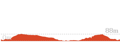
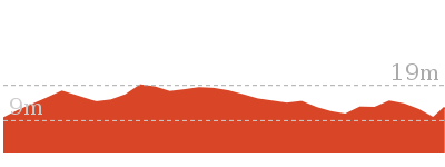
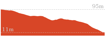
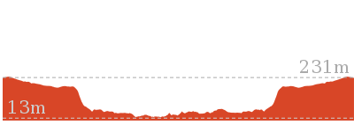
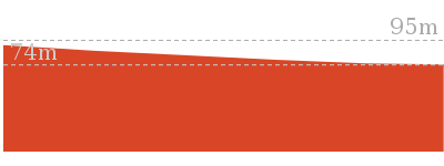
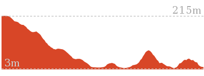
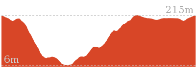
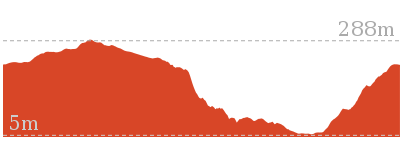
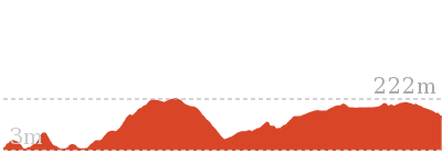
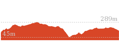
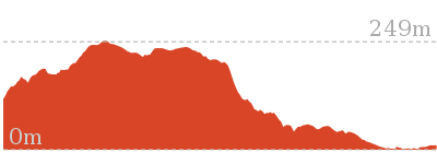
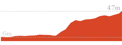
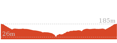
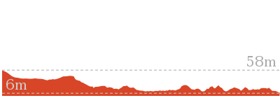
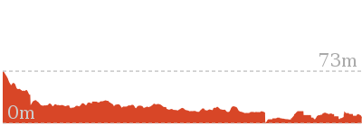
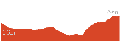
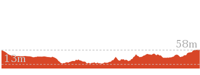
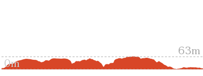
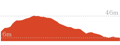
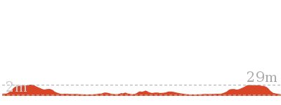
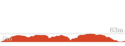
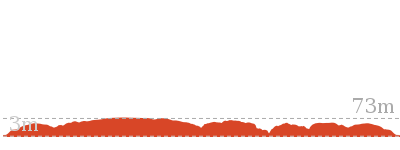
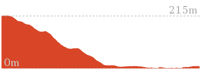
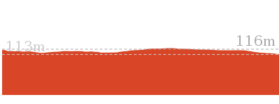
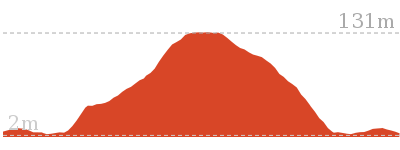
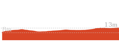
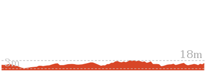
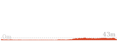
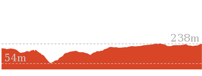
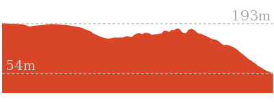
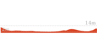
Cross sectional view of the Wattamola picnic area to Curracurrang Cove bushwalking track

Analysis and summary of the altitude variation on the Wattamola picnic area to Curracurrang Cove
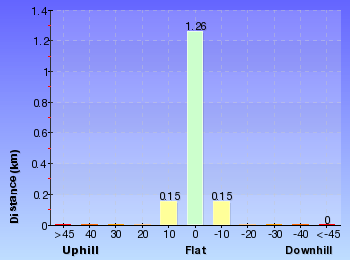
Overview of this walks grade – based on the AS 2156.1 – 2001
Under this standard, a walk is graded based on the most difficult section of the walk.
| Length | 3.1 km | ||
| Time | 1 hr 15 mins | ||
| . | |||
| Grade 3/6 Moderate track |
AS 2156.1 | Gradient | Short steep hills (3/6) |
| Quality of track | Formed track, with some branches and other obstacles (3/6) | ||
| Signs | Clearly signposted (1/6) | ||
| Experience Required | No experience required (1/6) | ||
| Weather | Weather generally has little impact on safety (1/6) | ||
| Infrastructure | Generally useful facilities (such as fenced cliffs and seats) (1/6) |
Some more details of this walks Grading
Here is a bit more details explaining grading looking at sections of the walk
Gradient
Around 1.4km of this walk has short steep hills, whilst the remaining 150m has gentle hills with occasional steps.
Quality of track
Around 1.4km of this walk follows a formed track, with some branches and other obstacles, whilst the remaining 150m follows a smooth and hardened path.
Signs
This whole walk, 1.6km is clearly signposted.
Experience Required
This whole walk, 1.6km requires no previous bushwalking experience.
weather
This whole walk, 1.6km is not usually affected by severe weather events (that would unexpectedly impact safety and navigation).
Infrastructure
This whole walk, 1.6km is close to useful facilities (such as fenced cliffs and seats).
Similar walks
A list of walks that share part of the track with the Wattamola picnic area to Curracurrang Cove walk.
Other Nearby walks
A list of walks that start near the Wattamola picnic area to Curracurrang Cove walk.
Plan your trip to and from the walk here
The Wattamola picnic area to Curracurrang Cove walk starts and ends at the Wattamolla Picnic Ground Toilet Block (gps: -34.138377, 151.11485)
Your main transport option to Wattamolla Picnic Ground Toilet Block is by;
![]() Car. There is free parking available.
Car. There is free parking available.
(get details)
Fire Danger
Each park may have its own fire ban, this rating is only valid for today and is based on information from the RFS Please check the RFS Website for more information.
Weather Forest
This walk starts in the Metropolitan weather district always check the formal BOM forecast or pdf before starting your walk.
Forecast snapshot
Park Information & Alerts
Short URL = http://wild.tl/wpatcc
Gallery images
There are other downloads I am still working on.
You will probably need to login to access these — still all free.
* KML (google earth file)
* GPX (GPS file)
Special Maps/ brochures
* A3 topo maps
* PDF with Lands Topo map base
* PDF with arial image (and map overlay)
I wanted to get the main site live first, this extra stuff will come in time.
Happy walking
Matt 🙂
Garawarra Farm carpark to figure eight pools

2 hrs 30 mins

273 m
Hard track
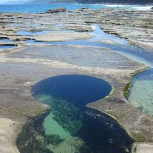
This return walk starts from the old Garawarra Farm car park and heads down the ridge through the Royal National Park, to the coast. The walk then follows the coast, through Burning Palms beach, and around the base of the headland to the famous Figure Eight Pools. This walk explores 4 distinct environments and gives a great cross section of what the park has to offer. The Figure Eight pools are on an ocean rock platform. Rock platforms can be very dangerous places, especially at high tide and during high seas. Only plan to visit the rock platform at low tide and low seas (see BOM website for forecast). Please also wear appropriate footwear for the walk and rock platforms.
Figure Eight Pools Safety

Please ensure you have enclosed and strudy shoes (thongs are not enough). There are no public facilities on the walk, please carry plenty of water, food and other surplies needed. Wear approriate clothes for the walk.
It is very very important that you only plan to visit the rock platform at low tide (check tides at http://www.bom.gov.au/australia/tides/#!/nsw-port-kembla)
It is also very very important to ensure the sea&swell forecast is 1.5m or less (http://www.bom.gov.au/australia/charts/viewer/index.shtml?type=sigWaveHgt&tz=AEDT&area=SEAu&model=WR
Even in perfect forecast conditions, always keep an eye on the sea (never turn your back to the ocean) and stay well back from the ocean edge of the rock platform.
Diving and jumping in any rock pools is likely to cause serious injury. Mobile phone reception is very limited on the walk and not available all the way.
Please watch this video and read the article to better understand the risks. http://bit.ly/1kZ3AbM.
Stay safe and have fun.
(0km) Garawarra Farm Carpark → The Squeeze Way and Burgh Ridge track

90 m
1 mins
2m
0m
Easy track
(0.09km) The Squeeze Way and Burgh Ridge track → Int of Burgh Ridge Track and Era Track (West)

970 m
23 mins
8m
-144m
Moderate track
(1.06km) Int of Burgh Ridge Track and Era Track (West) → Int of Coast Track and Burgh Ridge Track (Sth)

110 m
2 mins
4m
0m
Moderate track
(1.17km) Int of Coast Track and Burgh Ridge Track (Sth) → Burning Palms Beach (southern end)

940 m
18 mins
4m
-79m
Moderate track
(2.11km) Burning Palms Beach (southern end) → Figure 8 Pools

900 m
16 mins
15m
-17m
Hard track
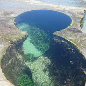
From the beach, this walk follows the rocky passage beneath the rocky headland (keeping the headland to the right). The walk rounds the first prominent headland to a creek that drops off the cliffs above. This walk heads out onto a second prominent headland to the Figure 8 Pools. There are a number of Figure 8-shaped pools, but one main one. The pools are towards the sea, in line with the gully.
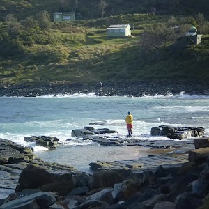
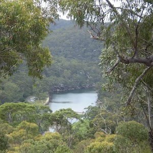
Figure Eight Pools

Maps for the Garawarra Farm carpark to figure eight pools walk
You can download the PDF for this walk to print a map.
These maps below cover the walk and the wider area around the walk, they are worth carrying for safety reasons.
| Otford | 1:25 000 Map Series | 91294S OTFORD | NSW-91294S |
| Port Hacking | 1:100 000 Map Series | 9129 PORT HACKING | 9129 |
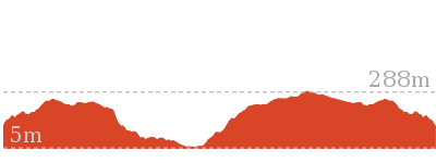
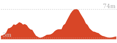
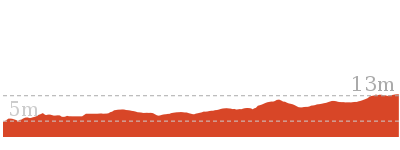
Cross sectional view of the Garawarra Farm carpark to figure eight pools bushwalking track

Analysis and summary of the altitude variation on the Garawarra Farm carpark to figure eight pools
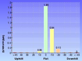
Overview of this walks grade – based on the AS 2156.1 – 2001
Under this standard, a walk is graded based on the most difficult section of the walk.
| Length | 6 km | ||
| Time | 2 hrs 30 mins | ||
| . | |||
| Grade 4/6 Hard track |
AS 2156.1 | Gradient | Short steep hills (3/6) |
| Quality of track | Rough track, where fallen trees and other obstacles are likely (4/6) | ||
| Signs | Minimal directional signs (4/6) | ||
| Experience Required | Some bushwalking experience recommended (3/6) | ||
| Weather | Storms may impact on navigation and safety (3/6) | ||
| Infrastructure | Limited facilities (such as cliffs not fenced, significant creeks not bridged) (4/6) |
Some more details of this walks Grading
Here is a bit more details explaining grading looking at sections of the walk
Gradient
Around 2.8km of this walk has short steep hills, whilst the remaining 200m is flat with no steps.
Quality of track
1.9km of this walk follows a formed track, with some branches and other obstacles and another 900m follows a rough track, where fallen trees and other obstacles are likely. The remaining (200m) follows a clear and well formed track or trail.
Signs
1.1km of this walk is clearly signposted and another 970m has directional signs at most intersection. The remaining (900m) has minimal directional signs.
Experience Required
Around 1.9km of this walk requires some bushwalking experience, whilst the remaining 1.1km requires no previous bushwalking experience.
weather
Around 2.1km of this walk is not usually affected by severe weather events (that would unexpectedly impact safety and navigation), whilst the remaining 900m is affected by storms that may impact your navigation and safety.
Infrastructure
2km of this walk has limited facilities (such as not all cliffs fenced) and another 900m has limited facilities (such as cliffs not fenced, significant creeks not bridged). The remaining (85m) is close to useful facilities (such as fenced cliffs and seats).
Similar walks
A list of walks that share part of the track with the Garawarra Farm carpark to figure eight pools walk.
Other Nearby walks
A list of walks that start near the Garawarra Farm carpark to figure eight pools walk.
Plan your trip to and from the walk here
The Garawarra Farm carpark to figure eight pools walk starts and ends at the Garawarra Farm Carpark (gps: -34.180069, 151.03931)
Your main transport option to Garawarra Farm Carpark is by;
![]() Car. A park entry fee is required for driving into the park.
Car. A park entry fee is required for driving into the park.
(get details)
Fire Danger
Each park may have its own fire ban, this rating is only valid for today and is based on information from the RFS Please check the RFS Website for more information.
Weather Forest
This walk starts in the Illawarra weather district always check the formal BOM forecast or pdf before starting your walk.
Forecast snapshot
Park Information & Alerts
Comments
Short URL = http://wild.tl/gfctfep
Gallery images
There are other downloads I am still working on.
You will probably need to login to access these — still all free.
* KML (google earth file)
* GPX (GPS file)
Special Maps/ brochures
* A3 topo maps
* PDF with Lands Topo map base
* PDF with arial image (and map overlay)
I wanted to get the main site live first, this extra stuff will come in time.
Happy walking
Matt 🙂
Marley Track
And Walk
Marley Track

4 hrs 30 mins

353 m
Hard track
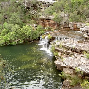
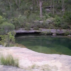
This walk takes you down from the ridge to the quiet Deer Pool on Marley Creek. You pass the Big and Little Marley beaches, with an optional side trip to Wattamola Dam. This side trip is well worth it on a hot day to take a dip. The walk then leads away from the coast to loop back to the starting point on Bundeena Drive.
(0km) Int. Marley Trk and Bundeena Drive → Deer Pools Clearing

1.9 km
38 mins
13m
-96m
Hard track
Deer Pool

(1.88km) Deer Pools Clearing → Int. Mowlee Ridge Trail and Marley Trk

560 m
11 mins
41m
-3m
Hard track
(2.44km) Int. Mowlee Ridge Trail and Marley Trk → North end of Chimney Trk

1 km
18 mins
7m
-38m
Moderate track
(3.47km) North end of Chimney Trk → Int. Coastal Trk and Chimney Trk

120 m
2 mins
0m
-9m
Moderate track
(3.59km) Int. Coastal Trk and Chimney Trk → West Marley Beach

240 m
4 mins
4m
-4m
Moderate track
Big Marley Beach

(3.59km) Int. Coastal Trk and Chimney Trk → Little Marley Beach

440 m
8 mins
5m
-11m
Moderate track
Little Marley Beach
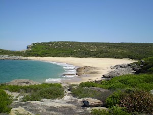
(4.03km) Little Marley Beach → Int. Coastal Trk NE of Wattamolla Ck

2.1 km
54 mins
174m
-96m
Moderate track
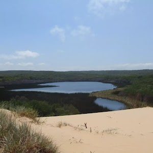
Wattamolla Dam

(6.12km) Int. Coastal Trk NE of Wattamolla Ck → Int. Mowlee Ridge Trail and Marley Trk

2.4 km
40 mins
14m
-47m
Moderate track
Turn right: From the intersection, this walk follows the management trail heading east, meandering through the thick green scrub over a number of small bumps (used for water diversion) as the track winds towards the coast. After a while, the management trail comes to the signposted intersection of the ‘Deer Pool’ bush track.
(8.51km) Int. Mowlee Ridge Trail and Marley Trk → Int. Marley Trk and Bundeena Drive

2.4 km
49 mins
99m
-54m
Hard track
Continue straight: From the clearing, this walk heads across the top of the waterfall, then follows the arrow on the sign across the creek on top of the waterfall to the other side. The track passes a clearing on the right as it continues up the hill, following the sprayed white dashes up the hill. The rather narrow track leads up the hill to the road, crossing a few rock platforms. The road is found about 350 meters past the old pipe with white spray-painted arrows. There is a ‘Marley Track’ sign just before Bundeena Drive, and a car park on the other side of the road (1.7km east of Mainbar Rd).
Maps for the Marley Track walk
You can download the PDF for this walk to print a map.
These maps below cover the walk and the wider area around the walk, they are worth carrying for safety reasons.
| Otford | 1:25 000 Map Series | 91294S OTFORD | NSW-91294S |
| Port Hacking | 1:25 000 Map Series | 91294N PORT HACKING | NSW-91294N |
| Port Hacking | 1:100 000 Map Series | 9129 PORT HACKING | 9129 |
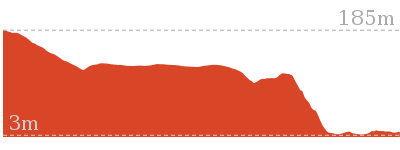
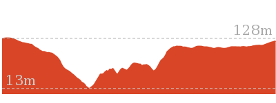
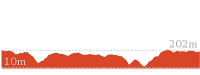
Cross sectional view of the Marley Track bushwalking track

Analysis and summary of the altitude variation on the Marley Track
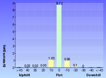
Overview of this walks grade – based on the AS 2156.1 – 2001
Under this standard, a walk is graded based on the most difficult section of the walk.
| Length | 11 km | ||
| Time | 4 hrs 30 mins | ||
| . | |||
| Grade 4/6 Hard track |
AS 2156.1 | Gradient | Short steep hills (3/6) |
| Quality of track | Formed track, with some branches and other obstacles (3/6) | ||
| Signs | Minimal directional signs (4/6) | ||
| Experience Required | Some bushwalking experience recommended (3/6) | ||
| Weather | Storms may impact on navigation and safety (3/6) | ||
| Infrastructure | Limited facilities (such as cliffs not fenced, significant creeks not bridged) (4/6) |
Some more details of this walks Grading
Here is a bit more details explaining grading looking at sections of the walk
Gradient
7km of this walk has short steep hills and another 3.5km has gentle hills with occasional steps. The remaining (440m) is flat with no steps.
Quality of track
Around 7km of this walk follows a formed track, with some branches and other obstacles, whilst the remaining 3.9km follows a clear and well formed track or trail.
Signs
4.9km of this walk has minimal directional signs and another 4km has directional signs at most intersection. The remaining (2.1km) is clearly signposted.
Experience Required
Around 9km of this walk requires no previous bushwalking experience, whilst the remaining 1.6km requires some bushwalking experience.
weather
Around 7km of this walk is not usually affected by severe weather events (that would unexpectedly impact safety and navigation), whilst the remaining 3.8km is affected by storms that may impact your navigation and safety.
Infrastructure
Around 6km of this walk has limited facilities (such as not all cliffs fenced), whilst the remaining 4.9km has limited facilities (such as cliffs not fenced, significant creeks not bridged).
Similar walks
A list of walks that share part of the track with the Marley Track walk.
Other Nearby walks
A list of walks that start near the Marley Track walk.
Plan your trip to and from the walk here
The Marley Track walk starts and ends at the Int. Marley Trk and Bundeena Drive (gps: -34.103046, 151.11575)
Your main transport option to Int. Marley Trk and Bundeena Drive is by;
![]() Car. There is free parking available.
Car. There is free parking available.
(get details)
Fire Danger
Each park may have its own fire ban, this rating is only valid for today and is based on information from the RFS Please check the RFS Website for more information.
Weather Forest
This walk starts in the Metropolitan weather district always check the formal BOM forecast or pdf before starting your walk.
Forecast snapshot
Park Information & Alerts
Comments
Short URL = http://wild.tl/19
Gallery images
There are other downloads I am still working on.
You will probably need to login to access these — still all free.
* KML (google earth file)
* GPX (GPS file)
Special Maps/ brochures
* A3 topo maps
* PDF with Lands Topo map base
* PDF with arial image (and map overlay)
I wanted to get the main site live first, this extra stuff will come in time.
Happy walking
Matt 🙂
Garie Beach to North Era Beach
And Walk
Garie Beach to North Era Beach

2 hrs

242 m
Moderate track
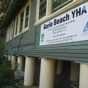
This walk is the shortest walk to North Era Beach and starts from the Garie car park. Both beaches are popular surfing beaches, and have either camping or basic hostel accommodation. This makes the walk between the beaches an excellent way to transport boards and supplies for your surf retreat, weekend getaway or just a nice stroll during the day.
Garie Beach
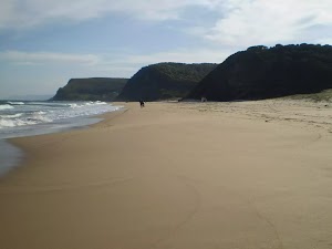
(0km) Garie Beach Car Park → Little Garie

750 m
20 mins
59m
-47m
Moderate track
(0.75km) Little Garie → North Era Bush Campground

850 m
23 mins
62m
-74m
Moderate track
North Era camping ground
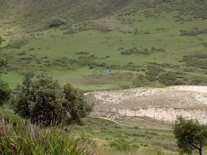
Maps for the Garie Beach to North Era Beach walk
You can download the PDF for this walk to print a map.
These maps below cover the walk and the wider area around the walk, they are worth carrying for safety reasons.
| Otford | 1:25 000 Map Series | 91294S OTFORD | NSW-91294S |
| Port Hacking | 1:100 000 Map Series | 9129 PORT HACKING | 9129 |
Cross sectional view of the Garie Beach to North Era Beach bushwalking track

Analysis and summary of the altitude variation on the Garie Beach to North Era Beach
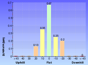
Overview of this walks grade – based on the AS 2156.1 – 2001
Under this standard, a walk is graded based on the most difficult section of the walk.
| Length | 3.2 km | ||
| Time | 2 hrs | ||
| . | |||
| Grade 3/6 Moderate track |
AS 2156.1 | Gradient | Short steep hills (3/6) |
| Quality of track | Formed track, with some branches and other obstacles (3/6) | ||
| Signs | Directional signs along the way (3/6) | ||
| Experience Required | No experience required (1/6) | ||
| Weather | Weather generally has little impact on safety (1/6) | ||
| Infrastructure | Limited facilities, not all cliffs are fenced (3/6) |
Some more details of this walks Grading
Here is a bit more details explaining grading looking at sections of the walk
Gradient
This whole walk, 1.6km has short steep hills.
Quality of track
Around 850m of this walk follows a clear and well formed track or trail, whilst the remaining 750m follows a formed track, with some branches and other obstacles.
Signs
Around 850m of this walk has directional signs at most intersection, whilst the remaining 750m is clearly signposted.
Experience Required
This whole walk, 1.6km requires no previous bushwalking experience.
weather
This whole walk, 1.6km is not usually affected by severe weather events (that would unexpectedly impact safety and navigation).
Infrastructure
Around 850m of this walk has limited facilities (such as not all cliffs fenced), whilst the remaining 750m is close to useful facilities (such as fenced cliffs and seats).
Similar walks
A list of walks that share part of the track with the Garie Beach to North Era Beach walk.
Other Nearby walks
A list of walks that start near the Garie Beach to North Era Beach walk.
Plan your trip to and from the walk here
The Garie Beach to North Era Beach walk starts and ends at the Garie Beach Car Park (gps: -34.170208, 151.06645)
Your main transport option to Garie Beach Car Park is by;
![]() Car. A park entry fee is required for driving into the park.
Car. A park entry fee is required for driving into the park.
(get details)
Fire Danger
Each park may have its own fire ban, this rating is only valid for today and is based on information from the RFS Please check the RFS Website for more information.
Weather Forest
This walk starts in the Metropolitan weather district always check the formal BOM forecast or pdf before starting your walk.
Forecast snapshot
Park Information & Alerts
Comments
Short URL = http://wild.tl/gbtneb
Gallery images
There are other downloads I am still working on.
You will probably need to login to access these — still all free.
* KML (google earth file)
* GPX (GPS file)
Special Maps/ brochures
* A3 topo maps
* PDF with Lands Topo map base
* PDF with arial image (and map overlay)
I wanted to get the main site live first, this extra stuff will come in time.
Happy walking
Matt 🙂
Mt Bass- Winifred Falls
And Walk
Mt Bass- Winifred Falls


2 hrs 30 mins

213 m
Hard track
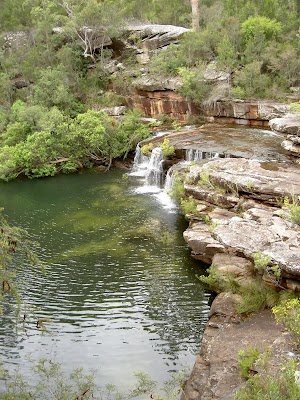
This walk follows Mount Bass Fire Trail, then a bush track, to Winifred Falls. Be prepared to get your feet wet crossing upper Winifred Falls. The Winifred Falls are really nice, and can be complemented by the brilliant side trip down to to South West Arm pools. These pools are a great place for a swim and a bite to eat before returning to the road.
(0km) Int. Bundeena Drive and Mt Bass Trail → Int. Mt Bass Trail and Anice and Winifred Falls Trks

2.6 km
45 mins
2m
-103m
Moderate track
Veer right: From the end of the management trail, this walk passes the pink ribbon marker on a branch, heading down the track through the trees. The walk continues for approximately 100m, keeping relatively straight, before coming to the sign marked intersection.
(2.63km) Int. Mt Bass Trail and Anice and Winifred Falls Trks → Upper Winifred Falls

690 m
17 mins
25m
-81m
Hard track
(3.33km) Upper Winifred Falls → South West Arm Pools Trk

40 m
1 mins
0m
-2m
Moderate track
Winifred Falls
(3.37km) South West Arm Pools Trk → South West Arm Pools

370 m
6 mins
2m
-9m
Hard track
Maps for the Mt Bass- Winifred Falls walk
You can download the PDF for this walk to print a map.
These maps below cover the walk and the wider area around the walk, they are worth carrying for safety reasons.
| Port Hacking | 1:25 000 Map Series | 91294N PORT HACKING | NSW-91294N |
| Port Hacking | 1:100 000 Map Series | 9129 PORT HACKING | 9129 |
Cross sectional view of the Mt Bass- Winifred Falls bushwalking track

Analysis and summary of the altitude variation on the Mt Bass- Winifred Falls
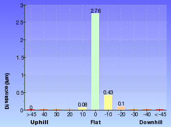
Overview of this walks grade – based on the AS 2156.1 – 2001
Under this standard, a walk is graded based on the most difficult section of the walk.
| Length | 6.7 km | ||
| Time | 2 hrs 30 mins | ||
| . | |||
| Grade 4/6 Hard track |
AS 2156.1 | Gradient | Short steep hills (3/6) |
| Quality of track | Rough track, where fallen trees and other obstacles are likely (4/6) | ||
| Signs | Directional signs along the way (3/6) | ||
| Experience Required | Some bushwalking experience recommended (3/6) | ||
| Weather | Weather generally has little impact on safety (1/6) | ||
| Infrastructure | Limited facilities (such as cliffs not fenced, significant creeks not bridged) (4/6) |
Some more details of this walks Grading
Here is a bit more details explaining grading looking at sections of the walk
Gradient
Around 2.7km of this walk has gentle hills with occasional steps, whilst the remaining 690m has short steep hills.
Quality of track
Around 2.7km of this walk follows a formed track, with some branches and other obstacles, whilst the remaining 690m follows a rough track, where fallen trees and other obstacles are likely.
Signs
This whole walk, 3.4km has directional signs at most intersection.
Experience Required
Around 2.7km of this walk requires no previous bushwalking experience, whilst the remaining 690m requires some bushwalking experience.
weather
This whole walk, 3.4km is not usually affected by severe weather events (that would unexpectedly impact safety and navigation).
Infrastructure
Around 2.7km of this walk has limited facilities (such as not all cliffs fenced), whilst the remaining 690m has limited facilities (such as cliffs not fenced, significant creeks not bridged).
Similar walks
A list of walks that share part of the track with the Mt Bass- Winifred Falls walk.
Other Nearby walks
A list of walks that start near the Mt Bass- Winifred Falls walk.
Plan your trip to and from the walk here
The Mt Bass- Winifred Falls walk starts and ends at the Int. Bundeena Drive and Mt Bass Trail (gps: -34.109099, 151.087)
Your main transport option to Int. Bundeena Drive and Mt Bass Trail is by;
![]() Car. There is free parking available.
Car. There is free parking available.
(get details)
Fire Danger
Each park may have its own fire ban, this rating is only valid for today and is based on information from the RFS Please check the RFS Website for more information.
Weather Forest
This walk starts in the Metropolitan weather district always check the formal BOM forecast or pdf before starting your walk.
Forecast snapshot
Park Information & Alerts
Comments
Short URL = http://wild.tl/mbwf
Gallery images
There are other downloads I am still working on.
You will probably need to login to access these — still all free.
* KML (google earth file)
* GPX (GPS file)
Special Maps/ brochures
* A3 topo maps
* PDF with Lands Topo map base
* PDF with arial image (and map overlay)
I wanted to get the main site live first, this extra stuff will come in time.
Happy walking
Matt 🙂
Loftus to Winifred Falls
And Walk
Loftus to Winifred Falls

4 hrs

400 m
Hard track
Following well-maintained bush tracks and service trails, this walk descends into the Royal National Park, to a spectacular set of pools and cascading falls on South Western Creek. The Royal National Park Information Centre, on Sir Bertram Stevens Drive, is approximately in the middle of this walk and is a great spot to grab a bite to eat before continuing to the falls. Unfortunately, it is necessary to have a car to get from Winifred Falls out of the park.
(0km) Loftus Station → Int of Princes Hwy and Royal National Park Servicetrail

680 m
12 mins
15m
-10m
Moderate track
(0.68km) Int of Princes Hwy and Royal National Park Servicetrail → Top of Honeymoon trail

2 km
33 mins
19m
-19m
Moderate track
Continue straight: From the top of the car park, this walk heads downhill through the car park towards the buildings (the area office). The walk heads down the grassy strip, keeping the area office to the left. At the bottom of the grassy clearing, the walk comes to the top of the ‘Honeymoon trail’ and information sign.
(2.67km) Top of Honeymoon track → Reid Park

1 km
23 mins
11m
-123m
Moderate track
(3.71km) Int of Honeymoon Track and Reid Park → Royal National Park Information Centre

320 m
7 mins
15m
-10m
Moderate track
(4.03km) Int. Winifred Falls Trk and Sir Bertram Stevens Dr → Sir Bertram Stevens Drive Access Int.

990 m
27 mins
120m
-5m
Hard track
(5.02km) Sir Bertram Stevens Drive Access Int. → Warumbul Rd Int.

1.2 km
22 mins
29m
-29m
Moderate track
(6.21km) Warumbul Rd → South West Arm Pools Trk

1.4 km
33 mins
5m
-117m
Moderate track
(7.63km) South West Arm Pools Trk → South West Arm Pools

370 m
6 mins
2m
-9m
Hard track
(7.63km) South West Arm Pools Trk → Int. Mt Bass Trail and Anice and Winifred Falls Trks

740 m
18 mins
83m
-25m
Hard track
Continue straight: From the creek and waterfall, this walk heads onto a rockshelf where the track turns right, heading steeply up the hill. The walk continues up the hill for approximately 50m to a creek. The track then traverses a spur to a second creek. The walk then continues for a short time to a sign marked intersection.
(8.36km) Int. Mt Bass Trail and Anice and Winifred Falls Trks → End Mount Bass Trail

340 m
6 mins
25m
0m
Moderate track
(8.7km) End Mount Bass Trail → Int. Bundeena Drive and Mt Bass Trail

2.3 km
39 mins
78m
-2m
Moderate track
Maps for the Loftus to Winifred Falls walk
You can download the PDF for this walk to print a map.
These maps below cover the walk and the wider area around the walk, they are worth carrying for safety reasons.
| Port Hacking | 1:25 000 Map Series | 91294N PORT HACKING | NSW-91294N |
| Port Hacking | 1:100 000 Map Series | 9129 PORT HACKING | 9129 |
Cross sectional view of the Loftus to Winifred Falls bushwalking track

Analysis and summary of the altitude variation on the Loftus to Winifred Falls
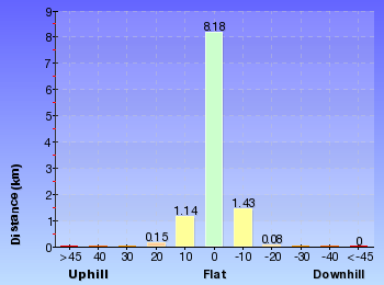
Overview of this walks grade – based on the AS 2156.1 – 2001
Under this standard, a walk is graded based on the most difficult section of the walk.
| Length | 11 km | ||
| Time | 4 hrs | ||
| . | |||
| Grade 4/6 Hard track |
AS 2156.1 | Gradient | Short steep hills (3/6) |
| Quality of track | Rough track, where fallen trees and other obstacles are likely (4/6) | ||
| Signs | Directional signs along the way (3/6) | ||
| Experience Required | Some bushwalking experience recommended (3/6) | ||
| Weather | Weather generally has little impact on safety (1/6) | ||
| Infrastructure | Limited facilities (such as cliffs not fenced, significant creeks not bridged) (4/6) |
Some more details of this walks Grading
Here is a bit more details explaining grading looking at sections of the walk
Gradient
5km of this walk has gentle hills with occasional steps and another 5km has short steep hills. The remaining (170m) is flat with no steps.
Quality of track
4.9km of this walk follows a formed track, with some branches and other obstacles and another 3.2km follows a clear and well formed track or trail. Whilst another 1.7km follows a rough track, where fallen trees and other obstacles are likely and the remaining 1.2km follows a smooth and hardened path.
Signs
Around 7km of this walk has directional signs at most intersection, whilst the remaining 4km is clearly signposted.
Experience Required
Around 8km of this walk requires no previous bushwalking experience, whilst the remaining 2.5km requires some bushwalking experience.
weather
This whole walk, 11km is not usually affected by severe weather events (that would unexpectedly impact safety and navigation).
Infrastructure
7km of this walk has limited facilities (such as not all cliffs fenced) and another 3km is close to useful facilities (such as fenced cliffs and seats). The remaining (690m) has limited facilities (such as cliffs not fenced, significant creeks not bridged).
Similar walks
A list of walks that share part of the track with the Loftus to Winifred Falls walk.
Other Nearby walks
A list of walks that start near the Loftus to Winifred Falls walk.
Plan your trip to and from the walk here
The Loftus to Winifred Falls walk starts at the Loftus Station (gps: -34.045276, 151.05147)
Your transport options to Loftus Station are by;
![]() Train. (get details)
Train. (get details)
![]() Car. There is free parking available.
Car. There is free parking available.
(get details)
The Loftus to Winifred Falls ends at the Int. Bundeena Drive and Mt Bass Trail (gps: -34.109099, 151.087)
Your main transport option to Int. Bundeena Drive and Mt Bass Trail is by;
![]() Car. A park entry fee is required for driving into the park.
Car. A park entry fee is required for driving into the park.
(get details)
Fire Danger
Each park may have its own fire ban, this rating is only valid for today and is based on information from the RFS Please check the RFS Website for more information.
Weather Forest
This walk starts in the Metropolitan weather district always check the formal BOM forecast or pdf before starting your walk.
Forecast snapshot
Park Information & Alerts
Comments
Short URL = http://wild.tl/ltwf
Gallery images
There are other downloads I am still working on.
You will probably need to login to access these — still all free.
* KML (google earth file)
* GPX (GPS file)
Special Maps/ brochures
* A3 topo maps
* PDF with Lands Topo map base
* PDF with arial image (and map overlay)
I wanted to get the main site live first, this extra stuff will come in time.
Happy walking
Matt 🙂
Stockyard spur to Garie Beach
And Walk
Stockyard spur to Garie Beach

1 hr 45 mins

142 m
Hard track
The walk down Stockyard Spur to Garie Beach is an excellent way to take in coastal views before following the Coastal Track. This is great if you are with a driver who is happy to drop you and wait for you are Garie Beach, or if you can do a car shuffle. You can always just walk back up. There are plenty of opportunities to get your feet wet if you wish to cool down on the walk, and you can see some of the houses built during the depression at North Era and Little Garie.
(0km) Int. Garie Rd and The Squeeze way → The Squeeze way and Stockyard Gully Trk

430 m
9 mins
10m
-22m
Moderate track
(0.43km) The Squeeze way and Stockyard Gully Trk → North Era Bush Campground

1.3 km
31 mins
11m
-206m
Hard track
Turn left : From the top of the ridge, the walk crosses the headland and open grassy area, down towards the beach (keeping the ocean to the right), coming to a ‘North Era Bush Campground’ sign just before the beach.
North Era camping ground

(1.73km) North Era Bush Campground → Little Garie

850 m
23 mins
74m
-62m
Moderate track
(2.57km) Little Garie → Garie Beach Car Park

750 m
20 mins
47m
-59m
Moderate track
Garie Beach

Maps for the Stockyard spur to Garie Beach walk
You can download the PDF for this walk to print a map.
These maps below cover the walk and the wider area around the walk, they are worth carrying for safety reasons.
| Otford | 1:25 000 Map Series | 91294S OTFORD | NSW-91294S |
| Port Hacking | 1:100 000 Map Series | 9129 PORT HACKING | 9129 |
Cross sectional view of the Stockyard spur to Garie Beach bushwalking track

Analysis and summary of the altitude variation on the Stockyard spur to Garie Beach
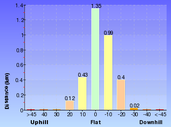
Overview of this walks grade – based on the AS 2156.1 – 2001
Under this standard, a walk is graded based on the most difficult section of the walk.
| Length | 3.3 km | ||
| Time | 1 hr 45 mins | ||
| . | |||
| Grade 4/6 Hard track |
AS 2156.1 | Gradient | Short steep hills (3/6) |
| Quality of track | Rough track, where fallen trees and other obstacles are likely (4/6) | ||
| Signs | Minimal directional signs (4/6) | ||
| Experience Required | No experience required (1/6) | ||
| Weather | Weather generally has little impact on safety (1/6) | ||
| Infrastructure | Limited facilities, not all cliffs are fenced (3/6) |
Some more details of this walks Grading
Here is a bit more details explaining grading looking at sections of the walk
Gradient
Around 2.9km of this walk has short steep hills, whilst the remaining 430m has gentle hills with occasional steps.
Quality of track
1.3km of this walk follows a clear and well formed track or trail and another 1.1km follows a rough track, where fallen trees and other obstacles are likely. The remaining (980m) follows a formed track, with some branches and other obstacles.
Signs
1.5km of this walk has directional signs at most intersection and another 1.1km has minimal directional signs. The remaining (750m) is clearly signposted.
Experience Required
This whole walk, 3.3km requires no previous bushwalking experience.
weather
This whole walk, 3.3km is not usually affected by severe weather events (that would unexpectedly impact safety and navigation).
Infrastructure
Around 2.6km of this walk has limited facilities (such as not all cliffs fenced), whilst the remaining 750m is close to useful facilities (such as fenced cliffs and seats).
Similar walks
A list of walks that share part of the track with the Stockyard spur to Garie Beach walk.
Other Nearby walks
A list of walks that start near the Stockyard spur to Garie Beach walk.
Plan your trip to and from the walk here
The Stockyard spur to Garie Beach walk starts at the Int. Garie Rd and The Squeeze way (gps: -34.170776, 151.05058)
Your main transport option to Int. Garie Rd and The Squeeze way is by;
![]() Car. A park entry fee is required for driving into the park.
Car. A park entry fee is required for driving into the park.
(get details)
The Stockyard spur to Garie Beach ends at the Garie Beach Car Park (gps: -34.170208, 151.06645)
Your main transport option to Garie Beach Car Park is by;
![]() Car. A park entry fee is required for driving into the park.
Car. A park entry fee is required for driving into the park.
(get details)
Fire Danger
Each park may have its own fire ban, this rating is only valid for today and is based on information from the RFS Please check the RFS Website for more information.
Weather Forest
This walk starts in the Metropolitan weather district always check the formal BOM forecast or pdf before starting your walk.
Forecast snapshot
Park Information & Alerts
Comments
Short URL = http://wild.tl/sstgb
Gallery images
There are other downloads I am still working on.
You will probably need to login to access these — still all free.
* KML (google earth file)
* GPX (GPS file)
Special Maps/ brochures
* A3 topo maps
* PDF with Lands Topo map base
* PDF with arial image (and map overlay)
I wanted to get the main site live first, this extra stuff will come in time.
Happy walking
Matt 🙂
Bundeena to Jibbon Head Circuit
And Walk
Bundeena to Jibbon Head Circuit

2 hrs 30 mins

139 m
Moderate track
On this loop walk you will enjoy some grand ocean views, a few secluded beaches, rock shelves and some Aboriginal engravings. The walk starts in the community of Bundeena and follows the roads to Jibbon Beach then along the track to Jibbon Head and Shelley beach, then a long stretch of sandy management trail through the heath. The walk also describes a side trip to Bundeena Lookout.
Bundeena
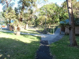
(0km) Bundeena Ferry Wharf → Corner of Loftus and Neil Streets

940 m
18 mins
29m
-18m
Very easy
(0.94km) Corner of Loftus and Neil Streets → Northern end of Jibbon Beach

750 m
12 mins
2m
-14m
Easy track
Jibbon Beach
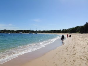
(1.69km) Northern end of Jibbon Beach → Little Jibbon Beach intersection

490 m
9 mins
9m
-6m
Moderate track
Little Jibbon Beach
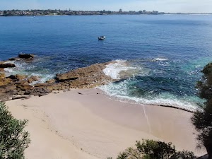
(2.18km) Little Jibbon Beach intersection → Jibbon Head Aboriginal Engravings

40 m
1 mins
3m
-1m
Easy track
Jibbon Head Aboriginal Engravings
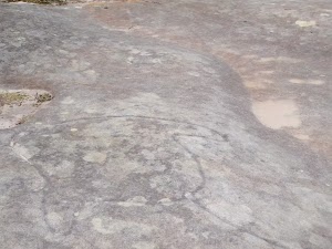
(2.18km) Little Jibbon Beach intersection → Jibbon Head

240 m
4 mins
5m
-8m
Moderate track
Jibbon Head
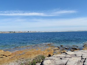
(2.42km) Jibbon Head → Shelley Beach

570 m
10 mins
14m
-10m
Moderate track
Shelley Beach
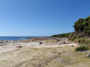
(2.99km) Shelley Beach → Int of Jibbon Loop and Coastal Walk tracks

20 m
1 mins
2m
0m
Easy track
(3.01km) Shelley Beach Int → Int of Jibbon Head and Beachcomber Rd Service Trails

2.1 km
39 mins
55m
-21m
Moderate track
(5.14km) Int of Jibbon Head and Beachcomber Rd Service Trails → Bundeena Lookout

760 m
14 mins
12m
-27m
Moderate track
Turn left: From the intersection, the walk follows the ‘Coast Track’ signpost along the wide, sandy bush track as it winds through the short, thick scrub for a while before arriving at the coast, where there are great views across the South Pacific Ocean.
At the end of this side trip, retrace your steps back to the main walk then Continue straight.
Bundeena Lookout
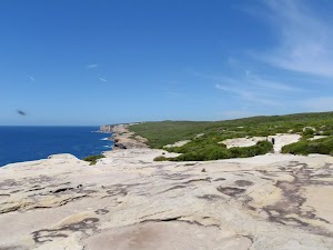
(5.14km) Int of Jibbon Head and Beachcomber Rd Service Trails → End of Beachcomber Av

130 m
2 mins
2m
-2m
Moderate track
(5.28km) End of Beachcomber Av → Bundeena Ferry Wharf

1.6 km
30 mins
21m
-61m
Easy track
Maps for the Bundeena to Jibbon Head Circuit walk
You can download the PDF for this walk to print a map.
These maps below cover the walk and the wider area around the walk, they are worth carrying for safety reasons.
| Port Hacking | 1:25 000 Map Series | 91294N PORT HACKING | NSW-91294N |
| Port Hacking | 1:100 000 Map Series | 9129 PORT HACKING | 9129 |
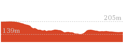
Cross sectional view of the Bundeena to Jibbon Head Circuit bushwalking track

Analysis and summary of the altitude variation on the Bundeena to Jibbon Head Circuit
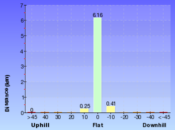
Overview of this walks grade – based on the AS 2156.1 – 2001
Under this standard, a walk is graded based on the most difficult section of the walk.
| Length | 6.8 km | ||
| Time | 2 hrs 30 mins | ||
| . | |||
| Grade 3/6 Moderate track |
AS 2156.1 | Gradient | Short steep hills (3/6) |
| Quality of track | Formed track, with some branches and other obstacles (3/6) | ||
| Signs | Directional signs along the way (3/6) | ||
| Experience Required | Some bushwalking experience recommended (3/6) | ||
| Weather | Weather generally has little impact on safety (1/6) | ||
| Infrastructure | Limited facilities, not all cliffs are fenced (3/6) |
Some more details of this walks Grading
Here is a bit more details explaining grading looking at sections of the walk
Gradient
2.7km of this walk has short steep hills and another 2.4km has gentle hills with occasional steps. The remaining (1.7km) is flat with no steps.
Quality of track
3.8km of this walk follows a clear and well formed track or trail and another 2.5km follows a smooth and hardened path. The remaining (570m) follows a formed track, with some branches and other obstacles.
Signs
Around 4.7km of this walk is clearly signposted, whilst the remaining 2.1km has directional signs at most intersection.
Experience Required
Around 4km of this walk requires no previous bushwalking experience, whilst the remaining 2.9km requires some bushwalking experience.
weather
This whole walk, 7km is not usually affected by severe weather events (that would unexpectedly impact safety and navigation).
Infrastructure
Around 3.8km of this walk is close to useful facilities (such as fenced cliffs and seats), whilst the remaining 3km has limited facilities (such as not all cliffs fenced).
Similar walks
A list of walks that share part of the track with the Bundeena to Jibbon Head Circuit walk.
Other Nearby walks
A list of walks that start near the Bundeena to Jibbon Head Circuit walk.
Plan your trip to and from the walk here
The Bundeena to Jibbon Head Circuit walk starts and ends at the Bundeena Ferry Wharf (gps: -34.082706, 151.15107)
Your transport options to Bundeena Ferry Wharf are by;
![]() Ferry. (get details)
Ferry. (get details)
![]() Car. A park entry fee is required for driving into the park.
Car. A park entry fee is required for driving into the park.
(get details)
Fire Danger
Each park may have its own fire ban, this rating is only valid for today and is based on information from the RFS Please check the RFS Website for more information.
Weather Forest
This walk starts in the Metropolitan weather district always check the formal BOM forecast or pdf before starting your walk.
Forecast snapshot
Park Information & Alerts
Comments
Short URL = http://wild.tl/btjhc
Gallery images
There are other downloads I am still working on.
You will probably need to login to access these — still all free.
* KML (google earth file)
* GPX (GPS file)
Special Maps/ brochures
* A3 topo maps
* PDF with Lands Topo map base
* PDF with arial image (and map overlay)
I wanted to get the main site live first, this extra stuff will come in time.
Happy walking
Matt 🙂
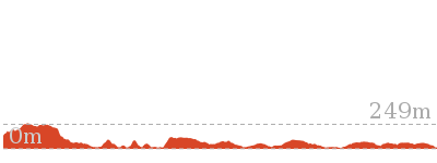
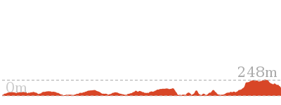
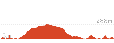
Garie Beach to Helensburgh (The Burgh Track)

4 hrs 30 mins

664 m
Hard track
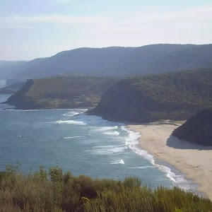
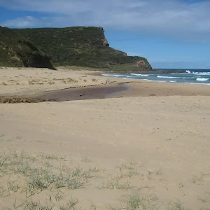
This walk has a great mixture of ocean cliffs, with fantastic views, and beautiful forest. The walk follows the well maintained Burgh Track, passing great views of the ocean and the cliffs, before turning inland and exploring some eucalypt forest on the way to Helensburgh. The environment and views near Lady Wakehurst Dr are incredibly special as the track winds its way through a shrouded eucalypt forest.
North Era camping ground

(0km) Garie Beach Car Park → Little Garie

750 m
20 mins
59m
-47m
Moderate track
(0.75km) Little Garie → North Era Bush Campground

850 m
23 mins
62m
-74m
Moderate track
(1.6km) North Era Bush Campground → Int of Burgh Ridge Track and Era Track (East)

910 m
20 mins
59m
-20m
Moderate track
Continue straight: From the top of the ridge, the walk heads down the hill, keeping the ocean to the left as it winds down between the cabins to the beach at the bottom. From here, the walk continues around the back of the beach following the coast, and up between the houses to the large clearing before the top of the hill. Here, the walk comes to an intersection with two rough bush tracks towards the top of the hill.
(2.51km) Int of Burgh Ridge Track and Era Track (East) → The Squeeze Way and Burgh Ridge track

1.3 km
32 mins
181m
-13m
Moderate track
Veer right: From the intersection, this walk follows the bush track heading up the hill and away from the ocean, towards the thick forest at the top of the ridge. The track winds up the long hill to the treeline, where it continues up through the forest, climbing to the top of the long hill where it gradually flattens out and comes to the intersection of the ‘Squeeze Way’ service trail at the end of the Garrawarra Farm car park.
(3.8km) The Squeeze Way and Burgh Ridge track → Int of Burgh and Bola Heights Tracks

330 m
6 mins
5m
-10m
Moderate track
Continue straight: From the ‘Burgh Track’ sign, this walk follows the sign away from the car park, keeping the paddock to the left. The track heads into the dense bushland, crossing a small creek and continuing along for a short while before coming to the intersection with the unnamed management trail.
(4.13km) Int of Burgh Track and Bola Heights Trail → Int of Lady Wakehurst Drive and Burgh Track

1.3 km
29 mins
11m
-163m
Moderate track
(5.47km) Int of Lady Wakehurst Drive and Burgh Track → Int of Burgh and Hacking River Tracks

890 m
19 mins
48m
-18m
Moderate track
(6.36km) Intersection of Hacking River Firetrail and Burgh Track → End of Halls Rd

3.5 km
1 hr 19 mins
214m
-114m
Hard track
(9.83km) End of Halls Rd → Helensburgh Railway Station

1.2 km
24 mins
25m
-69m
Moderate track
Maps for the Garie Beach to Helensburgh (The Burgh Track) walk
You can download the PDF for this walk to print a map.
These maps below cover the walk and the wider area around the walk, they are worth carrying for safety reasons.
| Otford | 1:25 000 Map Series | 91294S OTFORD | NSW-91294S |
| Appin | 1:25 000 Map Series | 90291S APPIN | NSW-90291S |
| Campbelltown | 1:50 000 Map Series | 90291 CAMPBELLTOWN | CW-90291 |
| Port Hacking | 1:100 000 Map Series | 9129 PORT HACKING | 9129 |
| Wollongong | 1:100 000 Map Series | 9029 WOLLONGONG | 9029 |
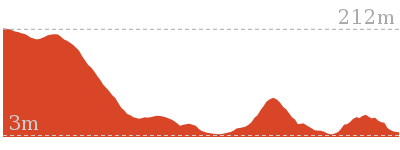
Cross sectional view of the Garie Beach to Helensburgh (The Burgh Track) bushwalking track

Analysis and summary of the altitude variation on the Garie Beach to Helensburgh (The Burgh Track)
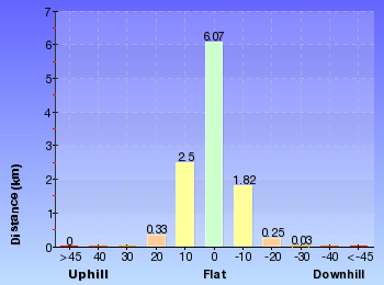
Overview of this walks grade – based on the AS 2156.1 – 2001
Under this standard, a walk is graded based on the most difficult section of the walk.
| Length | 11 km | ||
| Time | 4 hrs 30 mins | ||
| . | |||
| Grade 4/6 Hard track |
AS 2156.1 | Gradient | Short steep hills (3/6) |
| Quality of track | Formed track, with some branches and other obstacles (3/6) | ||
| Signs | Directional signs along the way (3/6) | ||
| Experience Required | Some bushwalking experience recommended (3/6) | ||
| Weather | Weather generally has little impact on safety (1/6) | ||
| Infrastructure | Limited facilities (such as cliffs not fenced, significant creeks not bridged) (4/6) |
Some more details of this walks Grading
Here is a bit more details explaining grading looking at sections of the walk
Gradient
11km of this walk has short steep hills and another 250m has gentle hills with occasional steps. The remaining (85m) is flat with no steps.
Quality of track
Around 7km of this walk follows a clear and well formed track or trail, whilst the remaining 3.8km follows a formed track, with some branches and other obstacles.
Signs
Around 8km of this walk has directional signs at most intersection, whilst the remaining 3.2km is clearly signposted.
Experience Required
Around 7km of this walk requires no previous bushwalking experience, whilst the remaining 3.8km requires some bushwalking experience.
weather
This whole walk, 11km is not usually affected by severe weather events (that would unexpectedly impact safety and navigation).
Infrastructure
7km of this walk has limited facilities (such as not all cliffs fenced) and another 3.5km has limited facilities (such as cliffs not fenced, significant creeks not bridged). The remaining (840m) is close to useful facilities (such as fenced cliffs and seats).
Similar walks
A list of walks that share part of the track with the Garie Beach to Helensburgh (The Burgh Track) walk.
Other Nearby walks
A list of walks that start near the Garie Beach to Helensburgh (The Burgh Track) walk.
Plan your trip to and from the walk here
The Garie Beach to Helensburgh (The Burgh Track) walk starts at the Garie Beach Car Park (gps: -34.170208, 151.06645)
Your main transport option to Garie Beach Car Park is by;
![]() Car. A park entry fee is required for driving into the park.
Car. A park entry fee is required for driving into the park.
(get details)
The Garie Beach to Helensburgh (The Burgh Track) ends at the Helensburgh Railway Station (gps: -34.176925, 150.99472)
Your transport options to Helensburgh Railway Station are by;
![]() Train. (get details)
Train. (get details)
![]() Car. There is free parking available.
Car. There is free parking available.
(get details)
Fire Danger
Each park may have its own fire ban, this rating is only valid for today and is based on information from the RFS Please check the RFS Website for more information.
Weather Forest
This walk starts in the Metropolitan weather district always check the formal BOM forecast or pdf before starting your walk.
Forecast snapshot
Park Information & Alerts
Comments
Short URL = http://wild.tl/gbthbt
Gallery images
There are other downloads I am still working on.
You will probably need to login to access these — still all free.
* KML (google earth file)
* GPX (GPS file)
Special Maps/ brochures
* A3 topo maps
* PDF with Lands Topo map base
* PDF with arial image (and map overlay)
I wanted to get the main site live first, this extra stuff will come in time.
Happy walking
Matt 🙂
Deer Pools
And Walk
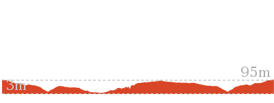
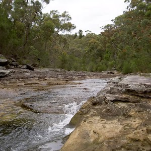
Deer Pools

1 hr 30 mins

109 m
Hard track
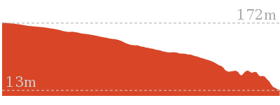
(0km) Int. Marley Trk and Bundeena Drive → Deer Pools Clearing

1.9 km
38 mins
13m
-96m
Hard track
Deer Pool

Maps for the Deer Pools walk
You can download the PDF for this walk to print a map.
These maps below cover the walk and the wider area around the walk, they are worth carrying for safety reasons.
| Port Hacking | 1:25 000 Map Series | 91294N PORT HACKING | NSW-91294N |
| Port Hacking | 1:100 000 Map Series | 9129 PORT HACKING | 9129 |
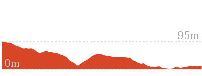
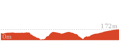
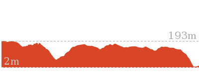
Cross sectional view of the Deer Pools bushwalking track

Analysis and summary of the altitude variation on the Deer Pools
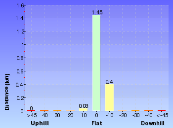
Overview of this walks grade – based on the AS 2156.1 – 2001
Under this standard, a walk is graded based on the most difficult section of the walk.
| Length | 3.8 km | ||
| Time | 1 hr 30 mins | ||
| . | |||
| Grade 4/6 Hard track |
AS 2156.1 | Gradient | Short steep hills (3/6) |
| Quality of track | Formed track, with some branches and other obstacles (3/6) | ||
| Signs | Minimal directional signs (4/6) | ||
| Experience Required | No experience required (1/6) | ||
| Weather | Storms may impact on navigation and safety (3/6) | ||
| Infrastructure | Limited facilities (such as cliffs not fenced, significant creeks not bridged) (4/6) |
Some more details of this walks Grading
Here is a bit more details explaining grading looking at sections of the walk
Gradient
This whole walk, 1.9km has short steep hills.
Quality of track
This whole walk, 1.9km follows a formed track, with some branches and other obstacles.
Signs
This whole walk, 1.9km has minimal directional signs.
Experience Required
This whole walk, 1.9km requires no previous bushwalking experience.
weather
This whole walk, 1.9km is affected by storms that may impact your navigation and safety.
Infrastructure
This whole walk, 1.9km has limited facilities (such as cliffs not fenced, significant creeks not bridged).
Similar walks
A list of walks that share part of the track with the Deer Pools walk.
Other Nearby walks
A list of walks that start near the Deer Pools walk.
Plan your trip to and from the walk here
The Deer Pools walk starts and ends at the Int. Marley Trk and Bundeena Drive (gps: -34.103046, 151.11575)
Your main transport option to Int. Marley Trk and Bundeena Drive is by;
![]() Car. There is free parking available.
Car. There is free parking available.
(get details)
Fire Danger
Each park may have its own fire ban, this rating is only valid for today and is based on information from the RFS Please check the RFS Website for more information.
Weather Forest
This walk starts in the Metropolitan weather district always check the formal BOM forecast or pdf before starting your walk.
Forecast snapshot
Park Information & Alerts
Comments
Short URL = http://wild.tl/14
Gallery images
There are other downloads I am still working on.
You will probably need to login to access these — still all free.
* KML (google earth file)
* GPX (GPS file)
Special Maps/ brochures
* A3 topo maps
* PDF with Lands Topo map base
* PDF with arial image (and map overlay)
I wanted to get the main site live first, this extra stuff will come in time.
Happy walking
Matt 🙂












Comments